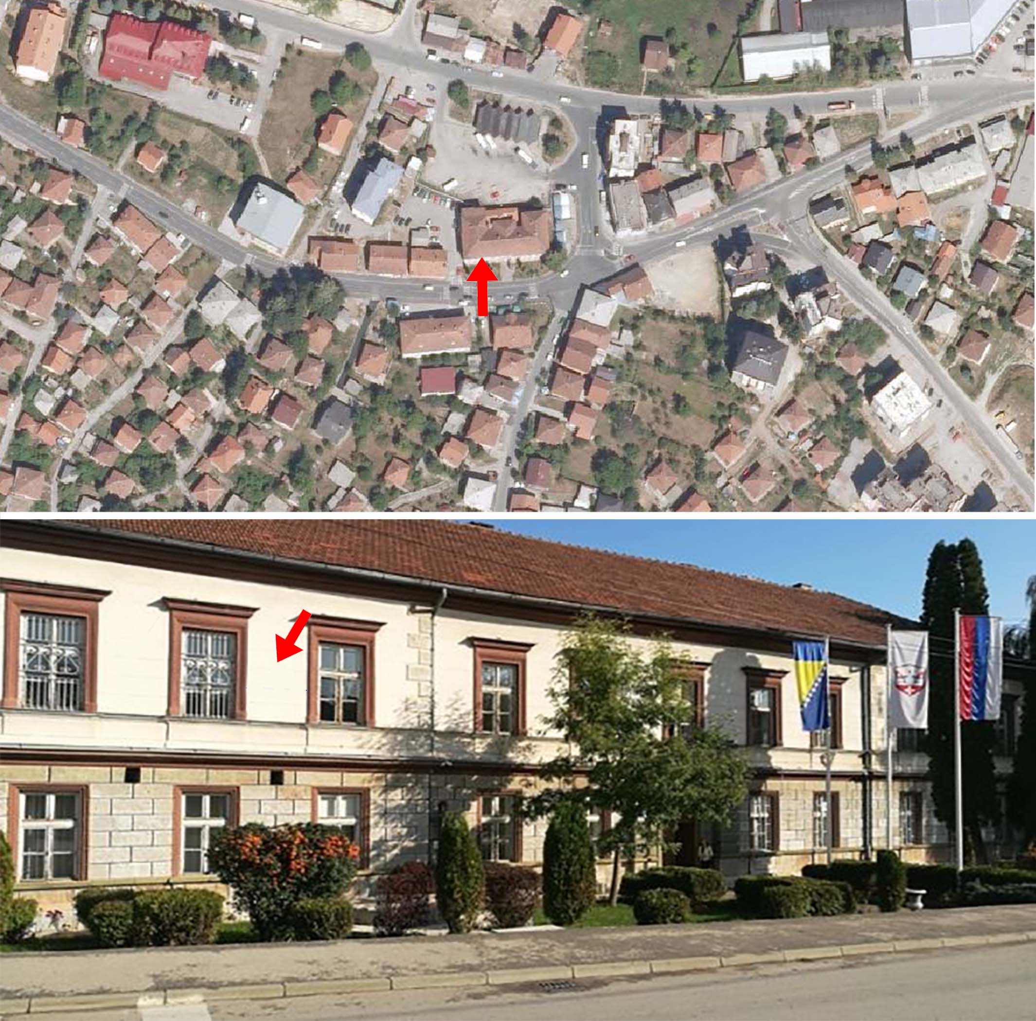
Municipality of Vlasenica (44° 10′ 59″ N, 18° 56′ 30″ E, А = 87.5°)
Figure 1. Orthophoto (above) and photo of the Vlasenica Municipality building (below); the arrow points to the location for the sundial.
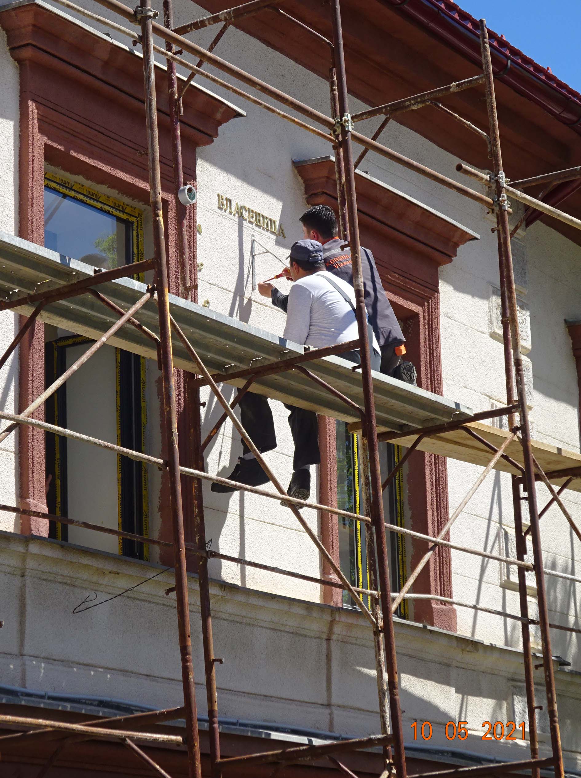
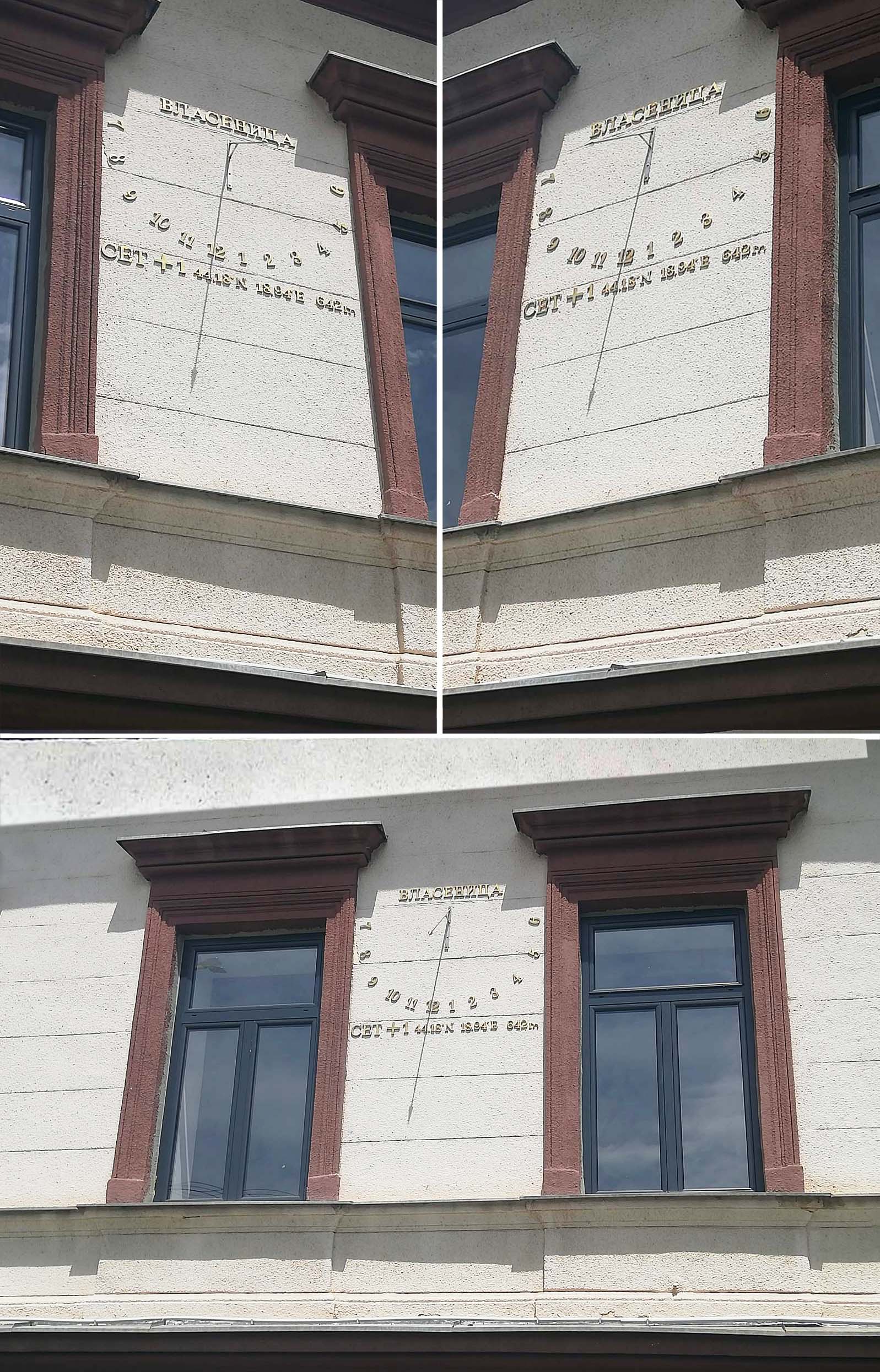
Figure 2. Installing the numbers and polos. Geographical coordinates and altitude are installed at the bottom.
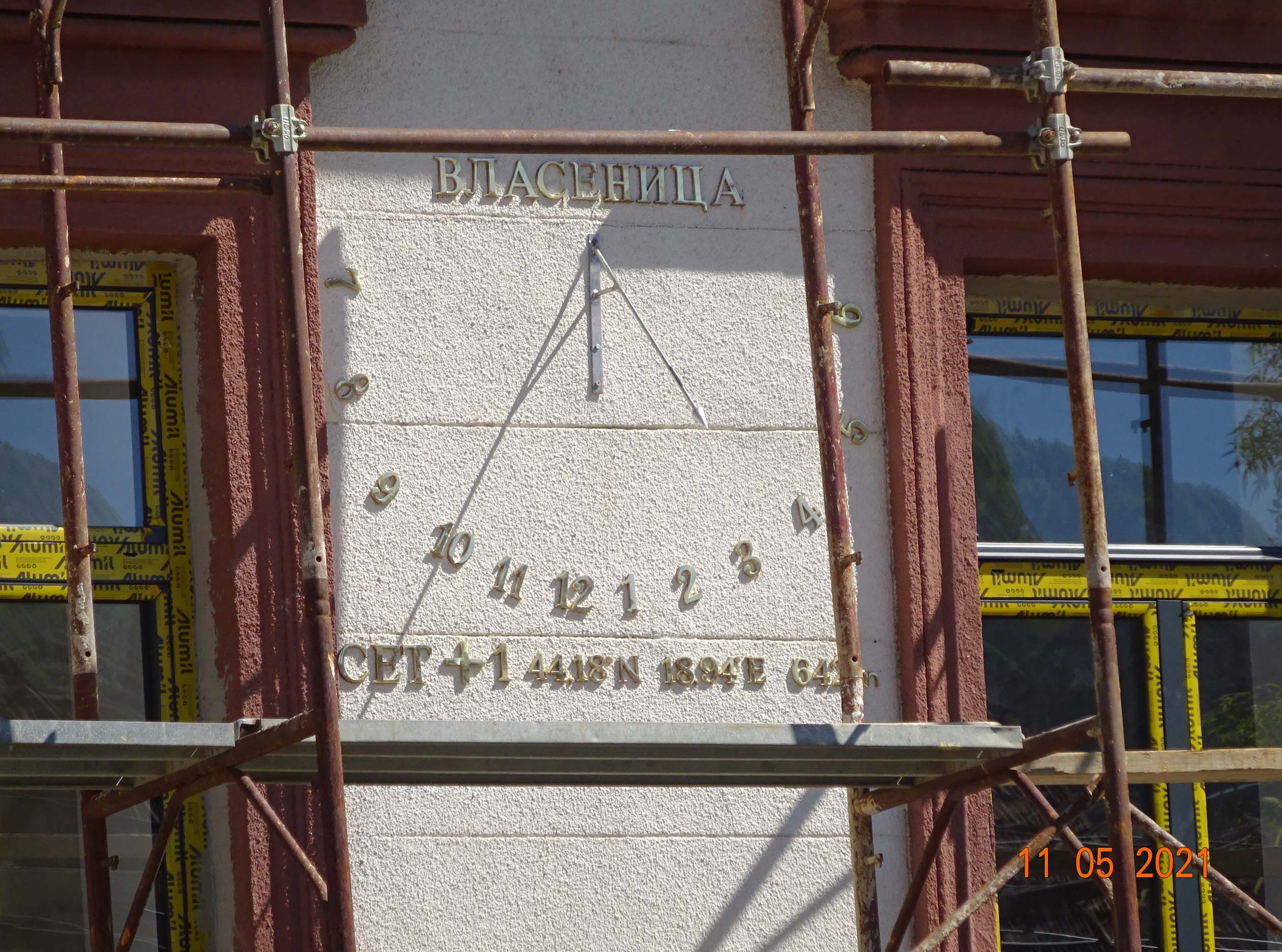
Figure 3. Photo of the sundial after completing installation.
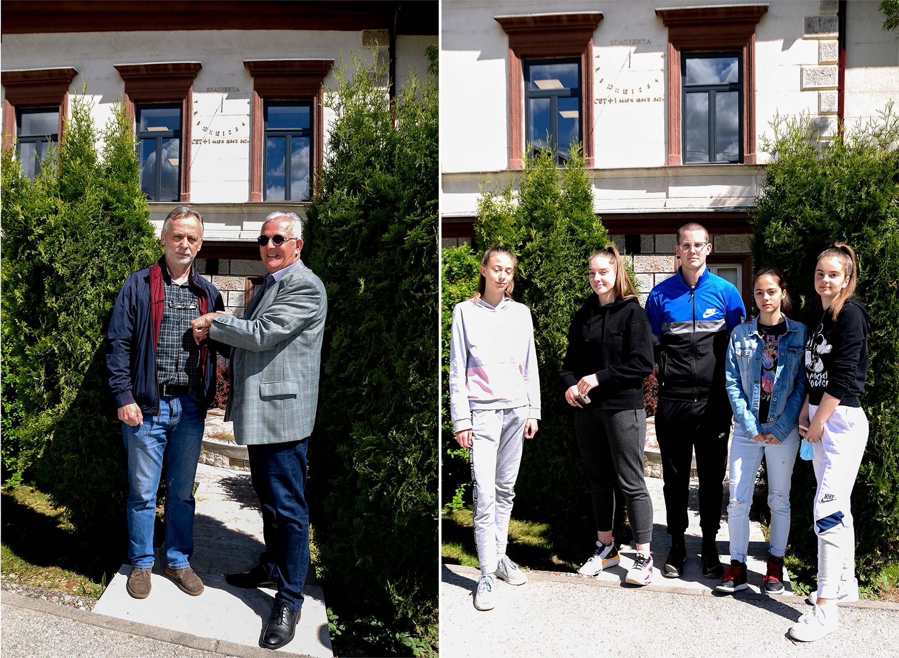
Figure 4. On the left: Dr Vidomir Obradović, Assistant Professor with Mr Paisia Petrović, Principal of the “Milorad Vlačić” High School in Vlasenica. On the right: High school students, winners of the National competition in geography awards.
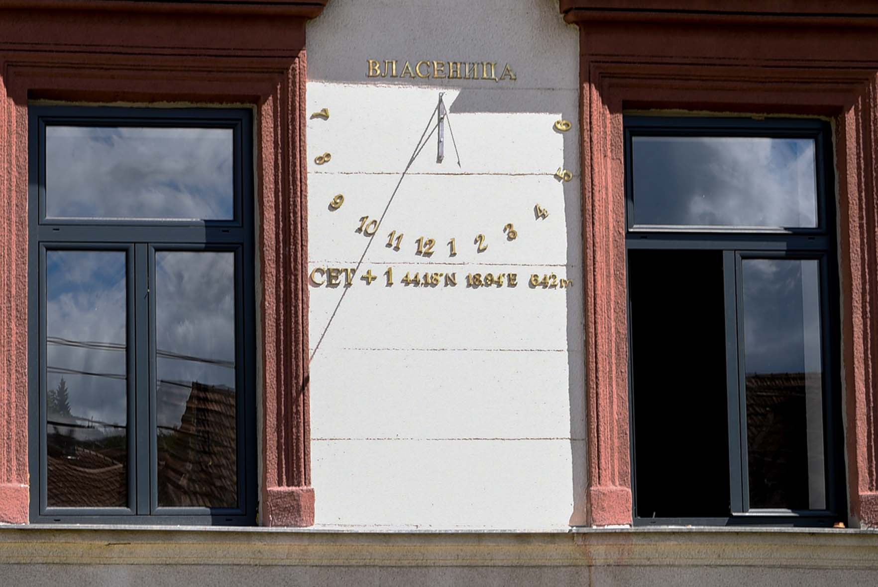
Figure 5. Checking accuracy of the sundial: the photo was taken on May 22 at 11:57 (Central European Summer Time, CET + 1); equation of time e = +3 min 18 s.